Wet and shivering, I rose from the outrigger of a Polynesian voyaging canoe. We’d been at sea all afternoon and most of the night. I’d hoped to get a little rest, but rain, wind and an absence of flat space made sleep impossible. My companions didn’t even try.
It was May 1972, and I was three months into doctoral research on one of the world’s most remote islands. Anuta is the easternmost populated outpost in the Solomon Islands. It is a half-mile in diameter, 75 miles (120 kilometers) from its nearest inhabited neighbor, and remains one of the few communities where inter-island travel in outrigger canoes is regularly practiced.
My hosts organized a bird-hunting expedition to Patutaka, an uninhabited monolith 30 miles away, and invited me to join the team.
We spent 20 hours en route to our destination, followed by two days there, and sailed back with a 20-knot tail wind. That adventure led to decades of anthropological research on how Pacific Islanders traverse the open sea aboard small craft, without “modern” instruments, and safely arrive at their intended destinations.
Wayfinding techniques vary, depending upon geographic and environmental conditions. Many, however, are widespread. They include mental mapping of the islands in the sailors’ navigational universe and the location of potential destinations in relation to the movement of stars, ocean currents, winds and waves.
Western interest in Pacific voyaging
Disney’s two “Moana” movies have shined a recent spotlight on Polynesian voyaging. European admiration for Pacific mariners, however, dates back centuries.
In 1768, the French explorer Louis Antoine de Bougainville named Sāmoa the “Navigators’ Islands.” The famed British sea captain James Cook reported that Indigenous canoes were as fast and agile as his ships. He welcomed Tupaia, a navigational expert from Ra‘iātea, onto his ship and documented Tupaia’s immense geographic knowledge.

In 1938, Māori scholar Te Rangi Hīroa (aka Sir Peter Buck) authored “Vikings of the Sunrise,” outlining Pacific exploration as portrayed in Polynesian legend.
In 1947, Thor Heyerdahl, a Norwegian explorer and amateur archaeologist, crossed from Peru to the Tuamotu Islands aboard a balsa wood raft that he named Kon-Tiki, sparking further interest and inspiring a sequence of experimental voyages.
Ten years later Andrew Sharp, a New Zealand-based historian and prominent naysayer, argued that accurate navigation over thousands of miles without instruments is impossible. Others responded with ethnographic studies showing that such voyages were both historic fact and current practice. In 1970, Thomas Gladwin published his findings on the Micronesian island of Polowat in “East Is a Big Bird.” Two years later, David Lewis’ “We, the Navigators” documented wayfinding techniques across much of Oceania.
Many anthropologists, along with Indigenous mariners, have built on Gladwin’s and Lewis’ work.
A final strand has been experimental voyaging. Most celebrated is the work of the Polynesian Voyaging Society. They constructed a double-hull voyaging canoe named Hōkūle‘a, built from modern materials but following a traditional design. In 1976, led by Micronesian navigator Mau Piailug, they sailed Hōkūle‘a over 2,500 miles, from Hawai‘i to Tahiti, without instruments. In 2017, Hōkūle‘a completed a circumnavigation of the planet.
In traversing Earth’s largest ocean, one can travel thousands of miles and see nothing but sky and water in any direction. Absent a magnetic compass, much less GPS, how is it possible to navigate accurately to the intended destination?
Looking to the stars
Most Pacific voyagers rely on celestial navigation. Stars rise in the east, set in the west, and, near the equator, follow a set line of latitude. If a known star either rises or sets directly over the target island, the helmsman can align the vessel with that star.
However, there are complications.
Which stars are visible, as well as their rising and setting points, changes throughout the year. Therefore, navigation requires detailed astronomical understanding.
Also, stars are constantly in motion. One that is positioned directly over the target island will soon either rise too high to be useful or sink below the horizon. Thus, a navigator must seek other stars that follow a similar trajectory and track them as long as they are visible and low on the horizon. Such a sequence of guide stars is often called a “star path.”
Of course, stars may not align precisely with the desired target. In that case, instead of aiming directly toward the guide star, the navigator keeps it at an appropriate angle.
A navigator must modify the vessel’s alignment with the stars to compensate for currents and wind that may push the canoe sideways. This movement is called leeway. Therefore, celestial navigation requires knowledge of the currents’ presence, speed, strength and direction, as well as being able to judge winds’ strength, direction and effect on the canoe.
During daylight, when stars are invisible, the Sun may serve a similar purpose. In early morning and late afternoon, when the Sun is low in the sky, sailors use it to calculate their heading. Clouds, however, sometimes obscure both Sun and stars, in which case voyagers rely on other cues.

Waves, wind and other indicators
A critical indicator is swells. These are waves produced by winds that blow steadily across thousands of miles of open sea. They maintain their direction regardless of temporary or local winds, which produce differently shaped waves called “seas.”
The helmsman, feeling swells beneath the vessel, gleans the proper heading, even in the dark. In some locations, as many as three or four distinct swell patterns may exist; voyagers distinguish them by size, shape, strength and direction in relation to prevailing winds.
Once sailors near their target island, but before it is visible, they must determine its precise location. A common indicator is reflected waves: swells that hit the island and bounce back to sea. The navigator feels reflected waves and sails toward them. Pacific navigators who have spent their lives at sea appear quite confident in their reliance on reflected waves. I, by contrast, find them difficult to differentiate from waves produced directly by the wind.

Certain birds that nest on land and fish at sea are also helpful. In early morning, one assumes they’re flying from the island; in late afternoon, they’re likely returning to their nesting spots.
Navigators sometimes recognize a greenish tint to the sky above a not-yet-visible island. Clouds may gather over a volcanic peak.
And sailors in the Solomon Islands’ Vaeakau-Taumako region report underwater streaks of light known as te lapa, which they say point toward distant islands. One well-known researcher has expressed confidence in te lapa’s existence and utility. Some scholars have suggested that it could be a bioluminescent or electromagnetic phenomenon. On the other hand, despite a year of concerted effort, I was unable to confirm its presence.
Estimating one’s position at sea is another challenge. Stars move along a given parallel and indicate one’s latitude. To gauge longitude, by contrast, requires dead reckoning. Navigators calculate their position by keeping track of their starting point, direction, speed and time at sea.
Some Micronesian navigators estimate their progress through a system known as etak. They visualize the angle between their canoe, pictured as stationary, and a reference island that is off to one side and represented as moving. Western researchers have speculated on how etak works, but there is no consensus yet.
For millennia, Pacific voyagers have relied on techniques such as these to reach thousands of islands, strewn throughout our planet’s largest ocean. They did so without Western instruments. Instead, they held sophisticated knowledge and shared understandings, passed by word of mouth, through countless generations.
This article is republished from The Conversation, a nonprofit, independent news organization bringing you facts and trustworthy analysis to help you make sense of our complex world. It was written by: Richard (Rick) Feinberg, Kent State University
Read more:
Richard (Rick) Feinberg has, in the past, received research funding from the National Science Foundation, the National Institute for Mental Health, and Kent State University. He is a member of the American Anthropological Association, the Association of Senior Anthropologists, and the Association for Social Anthropology in Oceania. He has maintained connections with people of the islands on which he has conducted research.
NEUESTE BEITRÄGE
- 1
 Mickey Lee of 'Big Brother' fame dead at 35 after flu complications, family says26.12.2025
 - 2The Significance of Health Projects in Senior Protection.19.10.2023
- 3Are multiverses real? An astrophysicist explains why it depends on how you define ‘real’30.03.2026
- 4Scientist turns people’s mental images into text using ‘mind-captioning’ technology14.11.2025
- 5Ultra-Orthodox protests erupt across Israel on haredi IDF enlistment day04.01.2026


Ähnliche Artikel
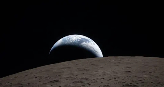
- Artemis 2 captures historic 'Earthset' photo | Space photo of the day for April 7, 202607.04.2026
- Tesla Germany Registrations Quadruple to 9,252 Vehicles in Best March Ever07.04.2026
- What's going on with Katseye? The Manon Bannerman hiatus drama, explained.07.04.2026
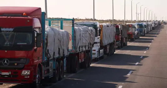
- Two IDF officers, civilian face indictment in alleged Gaza aid-truck smuggling scheme07.04.2026
- West Palm Beach Shorecrest, renderings of downtown waterfront condo07.04.2026
- Artemis II astronauts make long-distance call to the space station as they head home from the moon07.04.2026
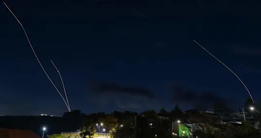
- Tuesday, April 7. Russia’s War On Ukraine: News And Information From Ukraine07.04.2026
- The Eastern Bongo, Kenya’s Rare Forest Antelope on the Brink07.04.2026
- U.K. blocks Kanye West from entering Britain to headline now canceled festival: What led to the ban07.04.2026
- Russia confirms 16 Cameroonian soldiers killed in Ukraine war07.04.2026
- First Phosphate advances battery-grade phosphate project as analysts highlight strategic Federal support07.04.2026
- After fleeing past Hezbollah fighting, some Israelis on northern border vow to stay07.04.2026
- 'Unreal' solar eclipse: Artemis 2 crew just saw one of the rarest sights in spaceflight history07.04.2026
- Chinese construction workers in Israel: 'I’d rather be bombed than live in poverty'07.04.2026
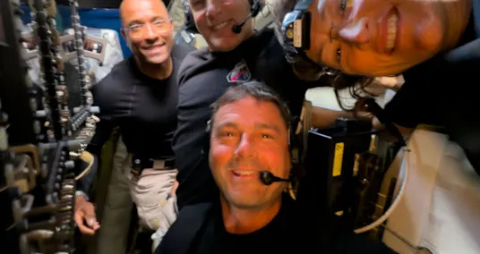
- Broken toilet, T-shirts on windows and collecting saliva: The weirdness of daily life aboard Orion07.04.2026
- Czech Republic caps fuel prices amid Iran war energy crisis07.04.2026
- NASA releases stunning new images captured by the Artemis II moon mission, including 'Earthset' and a solar eclipse from space07.04.2026
- Amid Iran war, 53 of Israel's future scientists showcase projects in Jerusalem contest07.04.2026
- Iranian-linked drone attack kills Kurdish couple in northern Iraq07.04.2026
- Thousands of small fish defy gravity to climb Congo waterfall07.04.2026